We're sorry but this listing is no longer available
The listing has been sold, removed or deactivated. Please try browsing all listings
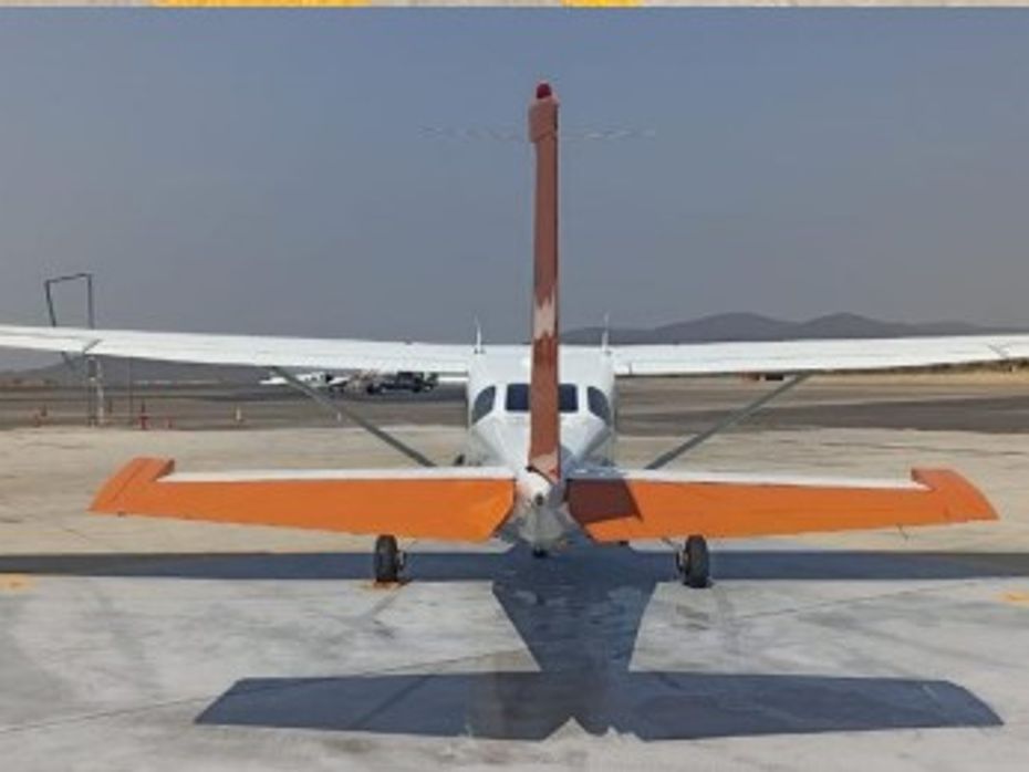
2000 CESSNA T206H STATIONAIR For Sale in Cuernavaca, Morelos Mexico
images 16
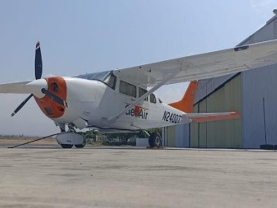
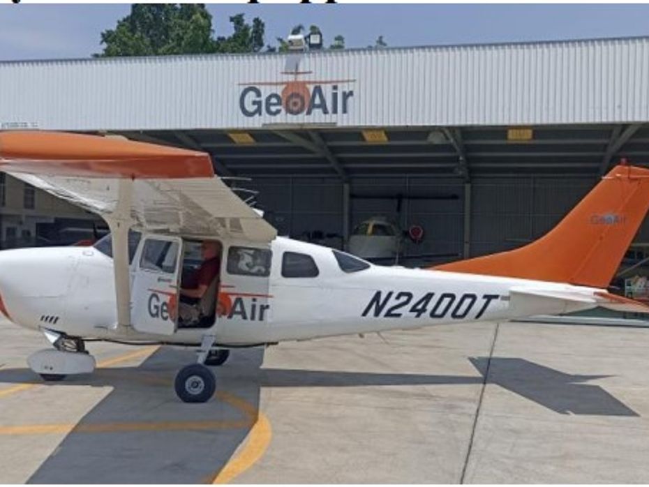
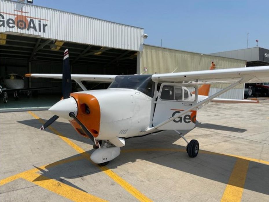
The 2000 Cessna T206H Stationair is a versatile survey aircraft widely used for aerial photography and mapping applications. Equipped with a specialized Camera Supplemental Type Certificate (STC), this aircraft offers enhanced capabilities for capturing high-quality images and data from the air.
The 2000 Cessna T206H Stationair is a versatile survey aircraft widely used for aerial photography and mapping applications. Equipped with a specialized Camera Supplemental Type Certificate (STC), this aircraft offers enhanced capabilities for capturing high-quality images and data from the air.
Details
- StatusFor Sale
- ConditionUsed
- Year2000
- MakeCESSNA
- ModelT206H STATIONAIR
- Reg #N2400T
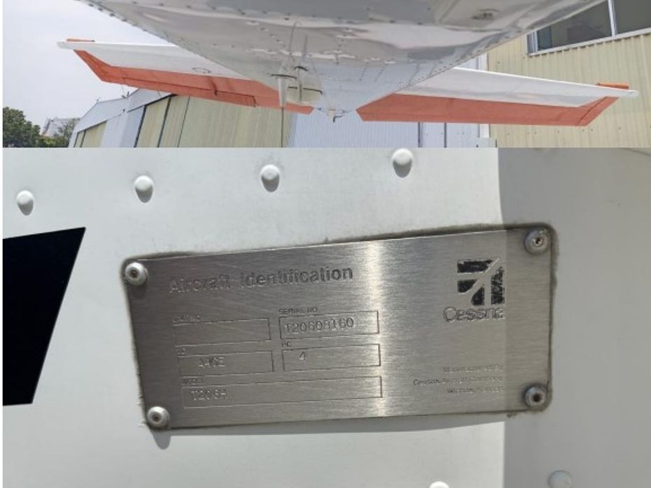
- Serial #T20608160
- Engine2541 hrs SOH
- Prop2329 hrs SPOH
- LocationCuernavaca, Morelos Mexico
- External URL
The 2000 Cessna T206H Stationair is a versatile survey aircraft widely used for aerial photography and mapping applications. Equipped with a specialized Camera Supplemental Type Certificate (STC), this aircraft offers enhanced capabilities for capturing high-quality images and data from the air.
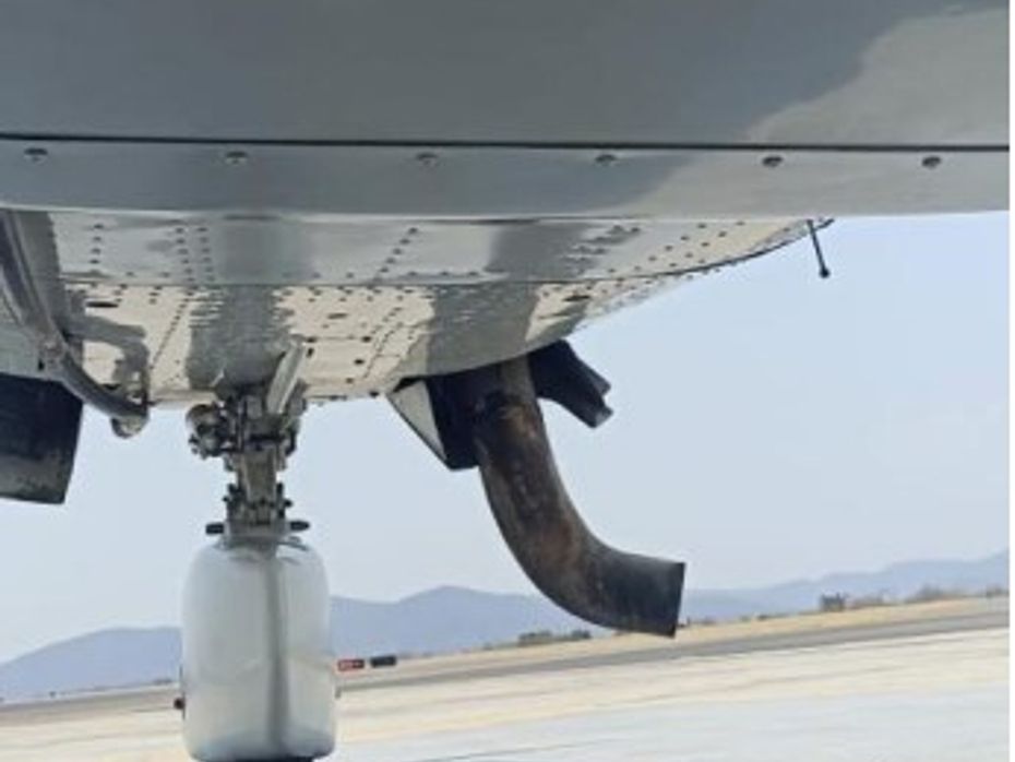
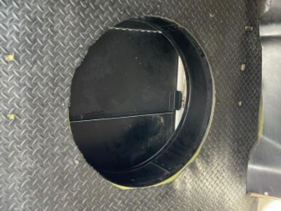
The aircraft has no damage history and was always hangered. Based in dry climate. No corrosion. Very good compressions: 1-74, 3-79, 5-78, 2-78, 4-72, 6-79. Exhaust extension. All seats available. Aerial survey / camera plane, modified by Straight Flight in 2014 Flint tip tanks
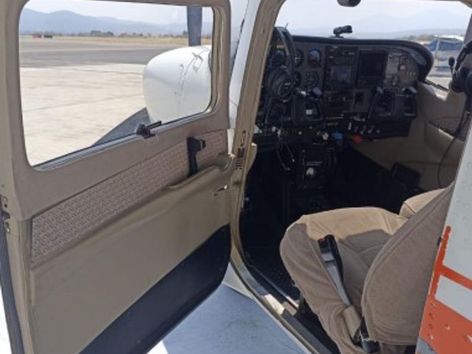
The T206H Stationair is renowned for its ruggedness, reliability, and impressive performance. Powered by a turbocharged 310-horsepower engine, it boasts excellent climb rates and cruise speeds, allowing it to efficiently cover large survey areas. With a spacious cabin, it accommodates a pilot and multiple survey crew members comfortably, ensuring smooth coordination during missions.
The Camera STC modification is specifically tailored for aerial survey work, enabling the integration of state-of-the-art camera systems. This includes advanced cameras with high-resolution sensors, specialized lenses, and gyroscopic stabilization for precise image capture even in challenging flight conditions. The camera system is seamlessly integrated into the aircraft's avionics and control systems, allowing for efficient operation and data collection.
The T206H Stationair's STC-equipped camera system enables the aircraft to conduct a wide range of survey missions. It is commonly utilized in mapping and photogrammetry projects, environmental monitoring, infrastructure inspections, and land surveys. The combination of the aircraft's stability, maneuverability, and the camera's capabilities allows for accurate and detailed data acquisition, contributing to various industries such as urban planning, agriculture, forestry, and natural resource management.
In summary, the 2000 Cessna T206H Stationair Survey Aircraft equipped with Camera STC offers a powerful platform for conducting aerial surveys. Its rugged design, reliable performance, and integrated camera system make it an ideal choice for capturing precise imagery and data from the air, supporting a multitude of survey applications across different industries.
- Very good compressions: 1-74, 3-79, 5-78, 2-78, 4-72, 6-79. Exhaust extension.
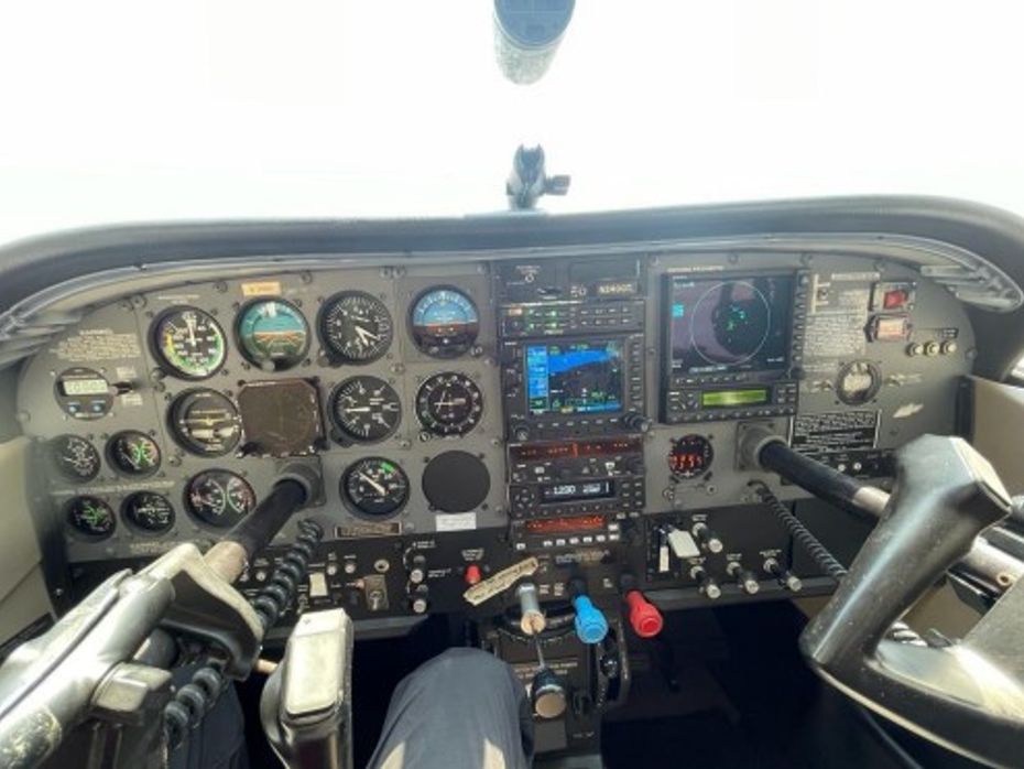
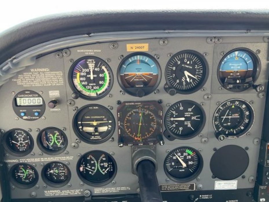
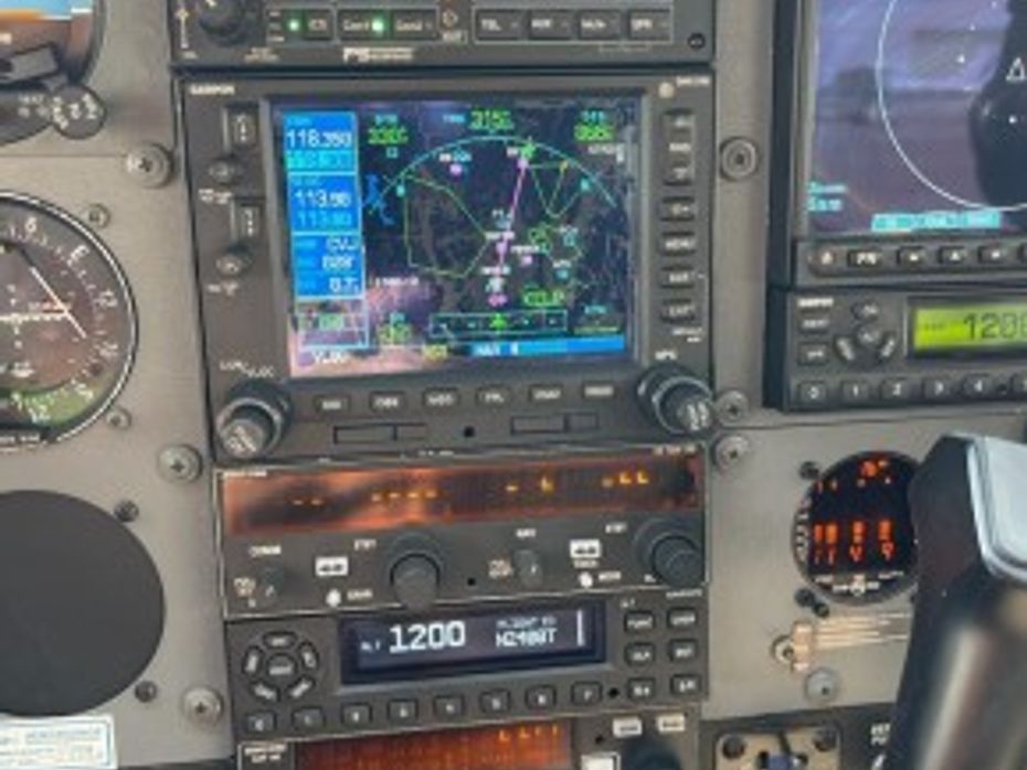
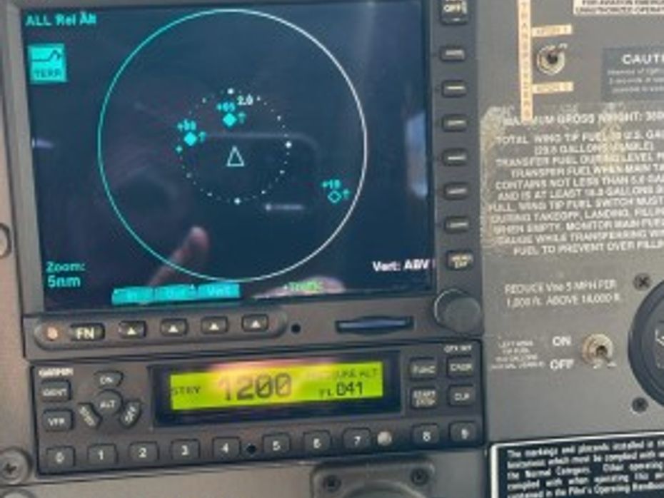
- Garmin GNS 530
- Garmin GNX 200 MFD
- Bendix King KX155A
- Sandel EHSI 3308
- Garmin ADSB in/out transponder
- Garmin GTX 327 transponder
- Bendix King KAP 140 autopilot
- BF Goodrich storm scope Wx 500
- Bendix King KC270C pitch servo
- BF Goodrich SK497
- PS Engineering PMA8000
- Mid Continent 3400 electric attitude gyro
- Davtron cronometer
- JPI engine monitor EDM800
 Cessna T206H Specification updated by Rick.pdf